Santa Ynez Already Has a Piece of the Valley Trail. A 2033 Bridge Decides When It Connects.
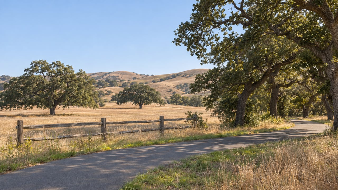
On the north side of Highway 246, a paved Class I bike path already sits inside Caltrans right-of-way. It runs from the Alamo Pintado Creek bridge east to Santa Ynez Valley Union High School. The high school end is pavement you can walk or ride today. At its west end the path reaches a creek crossing it cannot get across, and the bridge that will carry it over is on a state schedule that ends in fall 2033.
That one gap explains a lot about the Santa Ynez Valley Trail, the planned path of about nine miles from River View Park in Buellton to the junction of Highways 246 and 154. Santa Ynez has the stretch closest to finished on paper. It also has the two pieces of the corridor that are slowest to resolve: a bridge on Caltrans' clock to the west and the trail's tightest route options to the east. Buellton's end will almost certainly be built first.
In its September 18, 2025 staff report, the Santa Barbara County Association of Governments broke the corridor into pieces and judged each one. The segment from Solvang to Refugio Road was the only one it called "mainly complete." The existing path is the reason. The same report lists two jobs left on this segment. Caltrans will replace the Alamo Pintado Creek bridge and carry the path west to the Alamo Pintado Road intersection, and a separate future project will extend the trail along the high school's frontage to meet the segment farther east.
The path was not built with horses in mind. That matters in a township known for its equestrian roots. Fred Luna, SBCAG's director of project delivery and construction, told Noozhawk in October 2025 that the section near Alamo Pintado Road "was not built for horses." He said equestrian access would be limited to stretches where the terrain and infrastructure allow it, and that "some areas are wanting to see equestrians." In June 2026, Luna told the Santa Barbara News-Press that the existing stretch would likely get "some subtle improvements" as part of the project. "We have to make sure that the connections work," he said.
So the "mainly complete" segment comes down to one existing path with a bridge problem at one end and a frontage gap at the other.
The bridge is Caltrans' Alamo Pintado Bridge Replacement Project, EA 05-1M420, Bridge No. 51-0130. Caltrans is not replacing it to finish a trail. The agency rates the structure "scour critical," says it may lack enough bearing capacity during high-flow events, and has documented cracking in the portion widened in 1972. Because it is a state bridge project, it moves through the state's design, right-of-way and programming steps at the state's pace. It does not follow the trail's schedule.
When the new bridge is built, it will carry a 14-foot-wide Class 1 bikeway with a 2-foot barrier between the path and traffic. A new retaining wall on the northeast side will tie the new bikeway into the existing one, "allowing continuous travel to the Alamo Pintado Road intersection." The work also upgrades four outdated ADA curb ramps at that intersection. The project's final environmental document says the design adds no operational or capacity-increasing improvements. Drivers on Highway 246 get a sounder bridge with the same two lanes. People on foot and on bikes get a continuous connection.
The paperwork has moved this year. The California Transportation Commission signed off as a responsible agency on January 29, 2026, and the Notice of Determination was posted February 3, 2026. Caltrans' own schedule still runs out several years:
| Milestone | Caltrans schedule |
|---|---|
| Final environmental document | Winter 2025 |
| Right-of-way acquisition complete | Spring 2028 |
| Design complete | Spring 2028 |
| Advertise for bids | Summer 2028 |
| Construction begins | Winter 2029 |
| Construction complete | Fall 2033 |
In the state's 2026 SHOPP list as of the August 2026 close-out, the project sits in fiscal year 2027–28. The description reads "In and near Solvang, from Alamo Pintado Road to Entrance Road," with a total capital figure of $35.666 million. That total includes $17.723 million for construction and $4.858 million for right-of-way, plus a separate $1.204 million construction contribution from the City of Solvang. The project page's funding table, based on Caltrans' factsheet updated in July 2025, gives a construction cost of $28.491 million, with $24.161 million of it federal. The two figures count different things, and both describe a bridge project far larger than the path it will carry.
From the high school east, the planning is less settled. SBCAG's 2025 report says geographic constraints limit the alternatives for the Refugio Road to Highway 154 segment. The trail is expected to run parallel to and north of Highway 246, crossing Caltrans right-of-way and land owned by the Santa Ynez Band of Chumash Indians. The eastern endpoint is the 246 and 154 intersection, and the trail concept also anticipates the future Camp 4 community.
With few options, this segment comes down to agreements. Its route has to work for Caltrans, for the Tribe, and for SBCAG as project manager. The Tribe is already a funding partner. The 2025 staff report asked the SBCAG board to approve an MOU with the Santa Ynez Band of Chumash Indians so SBCAG could carry out the Tribe's FY 2025-26 Caltrans Sustainable Transportation Planning Grant of $383,016. That grant runs to June 30, 2028.
In June 2026, the News-Press reported that what the path might look like from the high school to Highway 154 was still undecided, as was where, or whether, equestrians might use the trail. SBCAG's August 11, 2026 update said the same thing for the whole corridor: "No final trail alignment has been selected." On the project's map site, the study map shows an evaluation area, not a chosen route.
SBCAG splits the corridor into segments that can advance as funding arrives. Segment A, inside Buellton, is the first headed for construction. From 2026 through 2028, the team plans environmental review, engineering, final design, right-of-way work and permitting for that piece. In Buellton, the trail follows the riverbank between River View Park and Avenue of Flags, where the city owns the land, holds easements, or has agreements to obtain them.
Buellton is going first because its land questions are settled. Segments B through F, which run through eastern Buellton, Solvang, unincorporated county land and the Reservation toward Highway 154, stay in a corridor-wide planning study over the same years. That study covers environmental and technical work and preliminary design, ahead of "future pre-construction efforts as additional funding becomes available." About $2.6 million in federal, state and local money has been secured for planning, environmental studies and preliminary design.
Here is the corridor as the planning documents describe it, from west to east:
| Segment | Status in SBCAG's 2025 report | What it waits on |
|---|---|---|
| Buellton riverbank | Well defined; land owned or under easement agreements | Design and permitting, 2026–2028 |
| Buellton to Solvang | Not finalized; one south-side landowner declined | Talks with north-side landowners |
| Through Solvang | Alternatives studied in Solvang's Active Transportation Plan | Depends on how the trail enters from the west |
| Solvang to Refugio Road | Mainly complete; existing Class I path | Caltrans bridge, plus the high school frontage extension |
| Refugio Road to Highway 154 | Constrained; expected north of and parallel to 246 | Caltrans right-of-way and Chumash-owned land |
The two rows that include Santa Ynez are the ones whose next step is set by someone other than SBCAG.
The idea is older than any of these segments. SBCAG traces it to at least Buellton's 2005 General Plan Update. The County's 2009 Santa Ynez Valley Community Plan included a trail that emphasized the Highway 246 corridor. SBCAG listed it as a "study corridor" in its 2015 Regional Active Transportation Plan. The 2019 Santa Ynez Valley Bicycle Master Plan, written at Solvang's request, made it the top-priority project. The September 2020 Santa Ynez River Trail Alignment Study covered only the Buellton to Solvang stretch and laid out alternatives without choosing one. By 2025, the concept had grown to reach Santa Ynez, the Reservation and Highway 154.
Officials have been talking about what the finished trail should look like, not only where it goes. At the SBCAG hearing the News-Press covered in June 2026, Solvang Mayor David Brown joked, "We're trying to decide which windmill we want it to go by." Fourth District Supervisor Bob Nelson, who chairs the SBCAG board, suggested making "maintenance and patrols" a formal part of the project. Sarah Iannarone, executive director of Move Santa Barbara County, urged SBCAG to convene stakeholders on access, tourism, e-bikes and design elements such as shade structures. Buellton council member Rose Hess, who sits on an SBCAG committee, told Noozhawk the trail "is going to look different as it moves along the different communities" and will be "relevant to the community and to the terrain."
For the Santa Ynez end, the question of what it should look like has a practical answer. East of the high school, the path is expected to follow the north side of Highway 246, and the open question is whether horses will share it. Tom Vo, SBCAG's project manager, said in the August update that "no trail alignment has been selected." He asked the public to help identify "the places, connections and local considerations we should evaluate." Location-specific comments, including spots where people ride horseback, can be pinned on the interactive map at SYVTrail.com.
The bike path to the high school will look the same for years. The Caltrans schedule calls for bids in summer 2028 and construction from winter 2029 through fall 2033.
Long public works timelines shape how Highway 246 properties are used day to day, from equestrian access to how a driveway meets the road. If you own or are considering land along the corridor and want a local read on what these projects could mean for it, J Finley Group can walk you through it. Request a Confidential Consultation.
Stay up to date on the latest real estate trends.
Get assistance in determining current property value, crafting a competitive offer, writing and negotiating a contract, and much more. Contact me today.
Get in touch to learn more.
ADDRESS
Compass
801 Chapala St
Santa Barbara, CA 93101
MAILING ADDRESS
PO Box 311, Santa Ynez, CA 94360